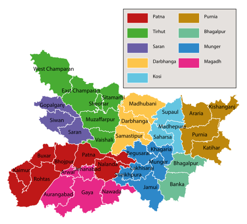
- Bihar is the thirteenth-largest Indian state, with an area of 94,163 km2 (36,357 sq mi).
- Bihar is the third-largest state of India.by population (10.4 crore)
- Bihar state is located between 24°-20′-10″ N ~ 27°-31′-15″ N latitude and between 83°-19′-50″ E ~ 88°-17′-40″ E longitude. Its average elevation above sea level is 173 feet (53 m).
- Bihar is contiguous with Uttar Pradesh to its west, Nepal to the north, the northern part of West Bengal to the east, with Jharkhand to the south.
- Bihar is an amalgamation of three distinct regions: Magadh, Mithila, and Bhojpur.
- Most of Bihar’s population belongs to Indo-Aryan-speaking ethnic groups along with few Dravidian-speaking and Austroasiatic-speaking people mostly in Chhotanagpur Plateau (now part of Jharkhand).
- On 15 November 2000, southern Bihar was ceded to form the new state of Jharkhand.
- After the 2011 Census, Bihar was the third most populous state of India with total population of 104,099,452 (54,278,157 male and 49,821,295 female).
- Nearly 89% of Bihar’s population lived in rural areas.
- Only 11.3% of the population of Bihar lives in urban areas, which is the lowest in India after Himachal Pradesh.
- According to 2011 census, the population density of Bihar was 1,106. The sex ratio was 918 females per 1000 males.
- As of the 2011 census, population density surpassed 1,000 per square kilometre, making Bihar India’s most densely-populated state, but still lower than West Java or Banten of Indonesia.
- According to 2011 census, Bihar has a total literacy rate of 63.82% (73.39% for males and 53.33% for females), recording a growth of 20% in female literacy over the period of a decade.
- According to the 2011 census, 82.7% of Bihar’s population practised Hinduism, while 16.9% followed Islam.
- Almost 58% of Biharis are below the age of 25, giving Bihar the highest proportion of young people of any Indian state.
- Bihar is a vast stretch of fertile plain. It is drained by the Ganges River, including its northern tributaries Gandak and Koshi, originating in the Nepal Himalayas and the Bagmati originating in the Kathmandu Valley that regularly flood parts of the Bihar plains.
- Central parts of Bihar have some small hills, for example the Rajgir hills. To the south is the Chota Nagpur plateau, which was part of Bihar until 2000 but now is part of a separate state called Jharkhand.
- Bihar has notified forest area of 6,764.14 km2 (2,612 sq mi), which is 7.2% of its geographical area.
BPSC Exam: Quick Geographical Facts about Bihar
CSS

